Besides the continuous application of the Information Technology (IT) into the management, the State Audit Office of Viet Nam has also actively adopted advanced technologies into its audit activities. Since then, it has witnessed remarkable changes in its work, proving that the technologies shall become an important tool to improve the effectiveness of audit activities. This effort also reflects the SAV’s strong commitment, in capacity as the Asian Organization of Supreme Audit Institutions (ASOSAI) Chair for the period of 2018-2021, to innovating the audit methodologies.
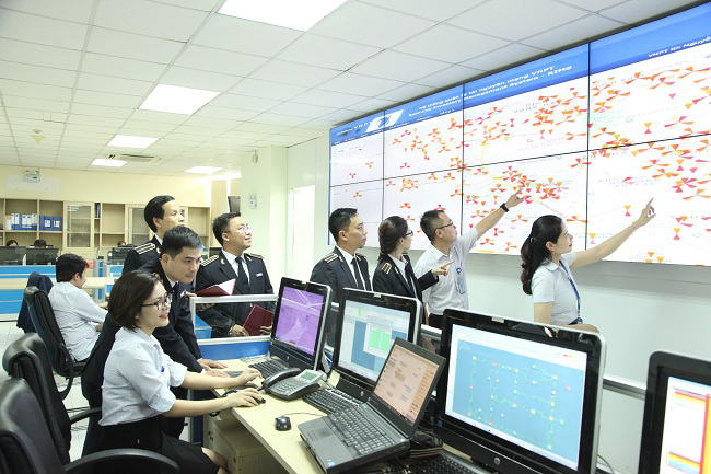
The IT application to help enhance the effectiveness of audit activities - Photo: Ngọc Bích
Unitlity and audit efficiency improvement
Facing the wave of technologies pouring into the diversed sectors and fields subject to the its audits, the SAV’s update and grasp of new technology innovation, then application thereof into reality is considered an inevitable trend, a vital task and an ideal solution to increase the quality and effectiveness of the audit work.
Being well aware of the role of and the application of IT into the Office’s work, the SAV’s has employed the new technologies into audit activities. The initial results showed fundamental changes in its work in comparison with that when using the traditional method.
Following are some examples in which the SAV has applied IT to assist its work:
Firstly, in the audit of the urban land which still remains fairly complicated and the audit quality is not as good as expected a group of auditors of the Regional Audit Office No. XII has learnt various pieces of software and exploited them into auditing the urban land planning and management, compensation and resettlement support while implementing the investment projects. There is some typical software like Global Mapper, Map Tiler to help auditors read and analyze digital data of land use and planning maps, land use plans; land boundary and situation determination comparing with the land use plans, etc.
The audit-assisting software has simplified auditors’ work, saving much more time for them than ever before. For example, looking back years ago, the auditors, when conducting audits of land use and planning, examined the paper - based documents and maps provided by the audited entities. It was difficult for auditors to detect the errors when comparing the land planning maps and land use plans, causing limitations in audit results, time waste in conducting the field visits to compare the boundaries, etc. Indeed, after using the software to compare the maps, all mentioned work has been completed in a short period of time.
Besides, when applying the software to pair the planning map with the GPS digital map system, the auditorscould accurately determine the location of the planned land in the area, thereby detecting the wrongdoings in land management. The audit findings were, thus, more general than that done by manual work.
Typically, through the application of technology to audit in Pleiku city and Ayun Pa town (Gia Lai), the audit team of the Regional Audit Office No. XII has found that: There were incompatibility between the land use plans and land planning in 87 areas of 325.89 ha in Pleiku city; In Ayun Pa town, there were 14 parts of 46.6 ha agricultural land having beenswitched to residential area with an area. This has led to the fact that the land use certificates licensed were not in line with the approved land use plan up to 2020.
Secondly, in audits of banking, MrsNguyễn Thị Thanh Loan (the specialised audit department No. VII) who has directly involved in building the credit scoring software (CR-CN7), said that after putting into use into real audits, the software has helped auditors to easily check the accuracy of loan debts classification, risk provision costs determination, elimination of audit risks caused by the manual changes of bank debts classification data. The new tool also supported the audit delegations in processing the audit data while auditing one clue for multi-branches of one bank system.
Along with IT applications, a number of other advanced technologies have also been applied by the SAV in recent years, bringing about positive effects. In particular, the application of remote sensing technology to the audit of mineral mining in Thuy Nguyen district (Hai Phong) directly conducted by the Regional Audit Office No. VI is a convincing proof for the impact of new technology in the audit efficiency.
According to former Deputy Chief Auditor of the SpecializedAudit Department No. VI Duong Quang Chinh (now the Director General of Inspection Department), the royaltiesare collected based on the outputs of the exploited natural resources. This caused a great limitation as it should be done based on the resource deposit.Consequently, the natural resources loss still happened when businesses tried to chose places with favorable conditions to exploit as they afraid to incur high costs while exploiting in a tough areas, plus the additional royalties. Besides, the output- based management without any effective method, the State has suffered an enormous loss of royalties worth trillions of VND.
This shortcoming has become a stimulus for the Regional Audit Office No. VI to seek for a more effective methodology of such audits. The answer was to employing the remote sensor technology into reality. And it has been proved that, since the change of the methodology, audit work has come up with spectacular results with the dramatic increase of the royalties collected compared with that before the technology.
Mr Duong Quang Chinh stated that, by using the caculation results made by the software, the SAV has shown the basis to identify mining boundaries, the actual output of the exploited minerals, then, helped to prevent illegal exploitation which caused the resources loss, environment destroying. Thanks to the application of the remote sensoring technology, the effectiveness, efficiency in management of natural resources exploitation have been remarkably improved, which helped to enhance the role of the SAV in the public assets protection.
Apart from the aforementioned technologies, SAV has also used several advanced technologies in its work such as concrete ultrasonic testing; big data processing and analysing software in finance and other professions (CAAT’s), etc.
The Specialised Audit Department No. VII was the unit that applied CAAT’s to analyse and process the big data of transactions and finance in some audits of commercial banks. Through the 3 financial - combining - IT audits in the commercial banks, the SAV has annouced impressive findings and made recommendations on fixing up IT system errors and risks which can be named like debt classification data, the risk provisions calculation remaining inaccurate and against the applicable regulations. Besides, the total amount of budget recommended to settled was 597 billion VND, making up 59% increase than that in the previous period.
Besides the increasing amount of money to be settled through the technology- applying audits than before, audit findings and recommendations which have been introduced thanks to the exploitation of the new software were totally agreed,then strictly followed by the audited entities.
Auditors of the Regional Audit Office No. XII to discuss the application of software in auditing – Photo by: Lưu Hường
Further application of new tools in the time to come
The initial results of the application of scientific and technological innovation in audit activities have not only provided more untility for the auditors in discharge of their professional tasks, helped improve the audit efficiency, but also challenged auditors to be more creative and innovative amid the digital age. However, in order for these technologies to become truly pervasive and widely applicable tools for audit activities, the SAV needs to carry out more in-depth studies and evaluation.
According to Mr. Duong QuangChinh, the results from the application of remote sensing technology to the audits of the mineral mining in Thuy Nguyen district (HaiPhong) have proven the feasibility of the rollout of this technology. “To apply this technology successfully, it is vitally important to have detailed studies, specifically from the selection of appropriate technology, to the development of processes, procedures and complete the legal basis for individual auditee and audit”- Mr. Chinh said.
According to Ms. Nguyen ThiThanh Loan, in order for the effective application of new software into audit activities, a workforce master in auditing and knowledgeable about IT to be able to coordinate with technology experts in developing IT applications is a decisive factor. The SAV therefore has proactively promoted trainings, recruiting staff with knowledge about IT and focused on introducing software to assist auditors in parallel with invested in audit profession assisting technology equipment to meet audit technical requirements.
The reality in the past time has raised demand in effectively applying the new technologies and making them important handy tool in support for the SAV’s audit work. To set a sound basis for the implementation of Office’s IT activities in the coming time in a way to strictly follow the orientation of building e-government, developing digital society, digital economy in Viet Nam, the Auditor General has approved the SAV’s IT Development and overall architecture Strategy for the period of 2019-2025, with a vision to 2030.
The strategy also identifies an appropriate roadmap to transform the traditional audit process to the digital based one with the advanced technologies, typically named as Big Data, artificial intelligence (AI), Internet of Things (IoT) through: digitizing, integrating data to create audited entities database useful for audit activities and well organizing these data; Using digital technology, especially AI, to analyze and use data sources in support for audit activities.
Notably, the draft of the SAV Development Strategy to 2030 (2020-2030, with a vision to 2035 also identifies one of the four fundamental pillars for the SAV to focus on: SAV’a development must be associated with the 4.0 Industrial Revolution, in which the application of IT in all SAV activities needs to become a regular and continuous task, both in short and long term.
The application of science and technology of the SAV, especially in the audit activities have been directed and represented in the SAV’s various development strategies and guiding documents. This proved its strong determination in international ntegration, proactive opportunities grasping, advantages taking and negative impacts mitigation of Industry Revolution 4.0.
Thanks to the application of scientific and technological advances in the audit activities, the SAV also demonstrates its pioneering and leading role as the Chair of ASOSAI 2018-2021. In addition to the operational role of ASOSAI, the State Audit of Vietnam has gradually affirmed its position within international auditing organizations and ASOSAI members by expressing its strong commitments and taking concrete actions to innovate the audit methodology.
|
Steps to use Global Mapper in combination with Map Tiler in audits of land use planning and management, site clearance compensation.
The combination of the Global Mapper and Map Tiler will maximise the efficiency of audits of the land use planning and management, the site clearance compensation. For example, for the audits of the site clearance compensation, there are steps to use software and applications as follows:
Step 1: Collect soft files of on cadastral maps, cadastral records before the time of site clearance compensation;soft files of on cadastral maps, cadastral records to support for project land acquisition;
Step 2: Check to ensure the uniformity of the mathematical bases and the reference system of the above cadastral maps (with the VN-2000 coordinate system). In case of the different reference system, it must be converted to the same system, but this case often leads to deviation;
Step 3: Use Global Mapper to open the above cadastral maps, because with the same mathematical bases and the reference system, these maps will match;
Reconcile with the reality by using the satellite map integration function, can extract the general map (after overlapping, combining the above cadastral maps) into mobile phones via the using Map Tiler to serve for field checking;
On the basis of comparison between the cadastral maps managed by the locality and the cadastral map for land acquisition, the areas of land overlapping with rivers, that under state management, unoccupied land are determined.
Step 4: Reconcile cadastral records (cadastral maps drawn by hand or with Hanoi - 72 coordinate system, list of books, certificates of land use rights granted to househouse in the overlapping areas) before the locality establishs land management database to determine the legality of the overlapping areas.
|
Steps to apply remote sensing technology to audits of mineral mining
Step 1: Preparations include planning the location and range of air-to-air photograph flight, checking the no-fly zone;
Step 2: Check if the weather conditions are suitable for air-to-air photograph taking (Check weather conditions and no-fly zones conducted by UAV Forecast software is provided free of charge and runs on iOS or Android);
Step 3:Design flight routes using specialized software and conduct air-to-air photograph taking: Design the flight altitude of the UAV based on a given pixel size; calculate the total number of UAV routes; calculate the total number of images to take and the amount of digital images and calculate the shutter speed;
Step 4: After having the air-to-air photograph taking results, the data thereof including digital images and coordinates of key point features will be loaded to image processing software AgisoftPhotoscan or similar software for stitching photos and creating digital ground models;
Step 5: When the air-to-air photograph taking process is over, the results thereof will be transferred to the computer and processed by a specialized software. Based on the coordinates of preliminary information when taking photos, the software will arrange the images in sequence, automatically detect key points features / tie points on the images, use the ground control points to perform automatic image matching. The data is then further processed, calculated in and out - oriented parameters; the volume is adjusted and interpolated to set up surface digital models as well as visual maps;
Step 6: The results as well as the calculation models will be used to analyze, overlay and evaluate for the different purposes of the project
|
BÁO KIỂM TOÁN